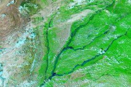
The Pyrenees Mountains in southwest Europe
Today’s Video of the Day from the European Space Agency features the Pyrenees Mountains, which form a natural boundary between France and Spain in southwest Europe.
The mountain range is 430 kilometers in length. It stretches from the Mediterranean Sea on the east to the Atlantic Ocean on the west.
At an elevation of 3404 meters, Pico de Aneto is the highest mountain peak in the Pyrenees, and the third-highest peak in Spain. Pico de Aneto is located in the Posets-Maladeta Natural Park, which spans more than 82,000 acres.
“Geological studies have revealed that the Pyrenees Mountains have been around for longer than the Alps, with their sediments first deposited in coastal basins during the Paleozoic and Mesozoic eras,” reports ESA.
“The entire mountain range formed due to the upwelling of large sedimentary rocks by the collision of the Iberian and the Eurasian plate around 100 to 150 million years ago, followed by intense erosion from ice and water.”
The western Pyrenees receive more precipitation due to moisture blowing in from the Atlantic Ocean. The mountain range contains many lakes, several small glaciers, and some of the highest waterfalls in Europe.
Video & Image Credit: ESA
–—
By Chrissy Sexton, Earth.com Editor
Check us out on EarthSnap, a free app brought to you by Eric Ralls and Earth.com.
News coming your way


