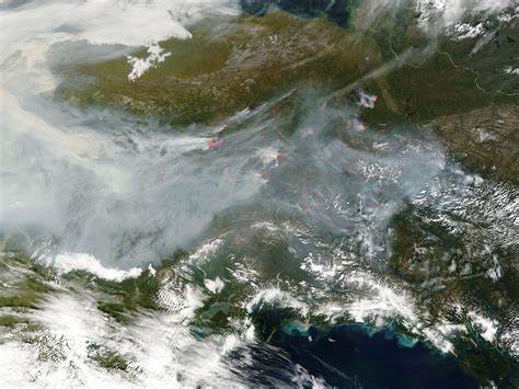
Wildfires Across Alaska

Wildfires Across Alaska Numerous forest fires were burning in the Yukon Flats region of east-central Alaska in mid-June 2004. The fires are burning in the wake of an incredibly active week of lightning, with a record-breaking, single-day total of 8,500 strikes on June 14, followed by another 6,200 strikes the next day (according to local news reports). These images from the Moderate Resolution Imaging Spectroradiometer (MODIS) on the Aqua satellite shows some of the largest, most rapidly growing fires on June19 and 20. Areas where MODIS detected fires are outlined in red.
The two northernmost fires in the scene, the Pingo and Winter Trail Fires, are the largest of several lightning-caused fires that are being collectively called the Solstice Complex. The Pingo was estimated to be 20,350 acres as of June 20, and the Winter Trail was 11,040.
Alaska is a U.S. state on the northwest extremity of the country’s West Coast, just across the Bering Strait. A semi-exclave of the U.S., it borders the Canadian province of British Columbia and territory of Yukon to the east and southeast and has a maritime border with Russia’s Chukotka Autonomous Okrug to the west. To the north are the Chukchi and Beaufort seas of the Arctic Ocean, while the Pacific Ocean lies to the south and southwest.
Credit: Jacques Descloitres, MODIS Rapid Response Team, NASA/GSFC


