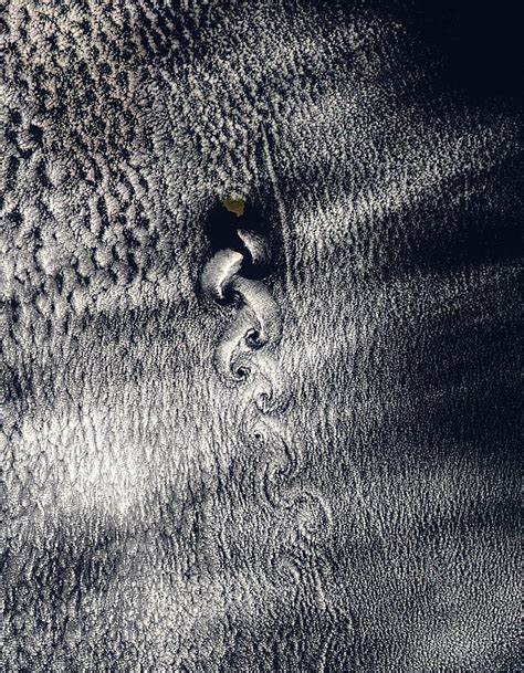
Vortex Street off Revillagigedo Archipelago

Vortex Street off Revillagigedo Archipelago. A braid of eddies behind the Revillagigedo Archipelago in the North Pacific have created the fanciful swirls in the clouds seen in these Moderate Resolution Imaging Spectroradiometer (MODIS) images, acquired by the Terra (morning) and Aqua (afternoon) satellites on May 13, 2004. The eddies form as air moving near the surface of the ocean is forced up and around the islands. The pattern became more distinct through the day, with the afternoon image showing a much clearer vortex street.
The Revillagigedo Islands (Spanish: Islas Revillagigedo, IPA: [reˈβiʝa xiˈxeðo]) or Revillagigedo Archipelago are a group of four volcanic islands in the Pacific Ocean, known for their unique ecosystem. They lie approximately 285 miles (458 km) from Socorro Island south and southwest of Cabo San Lucas, the southern tip of the Baja California Peninsula, and 698 to 1,092 kilometres (434 to 679 mi) west of Manzanillo. They are located around 18°49′N 112°46′WCoordinates: 18°49′N 112°46′W. Technically part of the Mexican state of Colima, the islands are under Mexican federal jurisdiction.
In July 2016, the Revillagigedo Archipelago were inscribed as a UNESCO World Heritage Site, and in November 2017 they were declared to be a marine reserve and a national park of Mexico.
Credit: Jacques Descloitres, MODIS Rapid Response Team, NASA/GSFC
News coming your way


