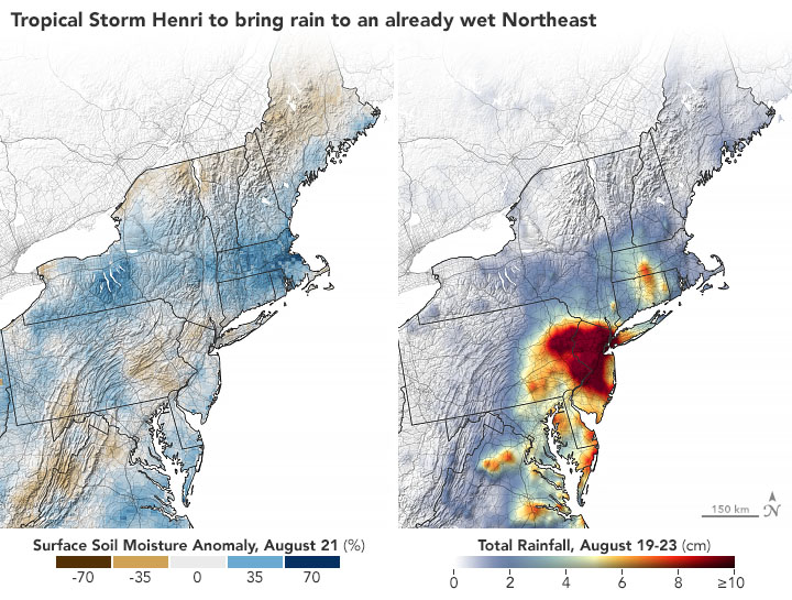
Tropical Storm Henri dumped months of rainfall in just a few days

Today’s Image of the Day from NASA Earth Observatory shows the extent of rainfall from Tropical Storm Henri in the northeast United States.
Henri made landfall near Westerly, Rhode Island, on August 22, 2021, with wind gusts of up to 70 miles per hour.
According to NASA, months of rain fell in just a few hours across New Jersey, New York, and several other states from August 21 to 23. Across this region, the slow-moving storm dumped rain on soils that were already soaked by one of the wettest summers on record.
Additional weather systems along the East Coast pulled in moisture from the outer edges of Henri, triggering torrential rainfall. By the time the storm had passed on August 23, gauges in New York City’s Central Park recorded a total of 8.19 inches of rain.
“Henri’s slow westward-then-eastward loop across southern New England over a period of more than 24 hours while still classified as a tropical cyclone is extremely unusual if not unprecedented,” meteorologist Bob Henson wrote in a blog post.
“Nearly all tropical depressions, tropical storms, or hurricanes in the region move more rapidly north or northeast, hauled toward the Atlantic by strong upper-level winds more typical at that latitude than the exceptionally weak steering currents present on Monday.”
Image Credit: NASA Earth Observatory
–—
By Chrissy Sexton, Earth.com Staff Writer
News coming your way


