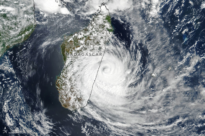
Tropical Cyclone Emnati bears down on Madagascar

Today’s Image of the Day from NASA Earth Observatory features Tropical Cyclone Emnati in the Indian Ocean. This is the fifth storm to bring heavy rainfall and damaging winds to Madagascar in just six weeks.
According to NASA, Tropical Cyclone Emnati is expected to make landfall along the eastern coast between the cities of Mananjary and Manakara late on February 22, 2022.
The image was captured by the Visible Infrared Imaging Radiometer Suite (VIIRS) on the NOAA-NASA Suomi NPP satellite. At this time, Emnati had sustained winds of 85 miles per hour. Winds peaked at 125 miles per hour on February 20.
“Forecasters were expecting widespread rainfall totals of 10 to 20 centimeters (4 to 8 inches) in regions that were just soaked by 20+ centimeters at the beginning of February,” reports NASA.
“New fooding is possible in areas where more than 20,000 people are still displaced two weeks after Batsirai made landfall. However, the storm could bring needed rain to drought-stricken southern parts of Madagascar.”
Image Credit: NASA Earth Observatory
–—
By Chrissy Sexton, Earth.com Staff Writero L())?((m mm?
News coming your way


