Shocking wildfire outbreak persists in Turkey

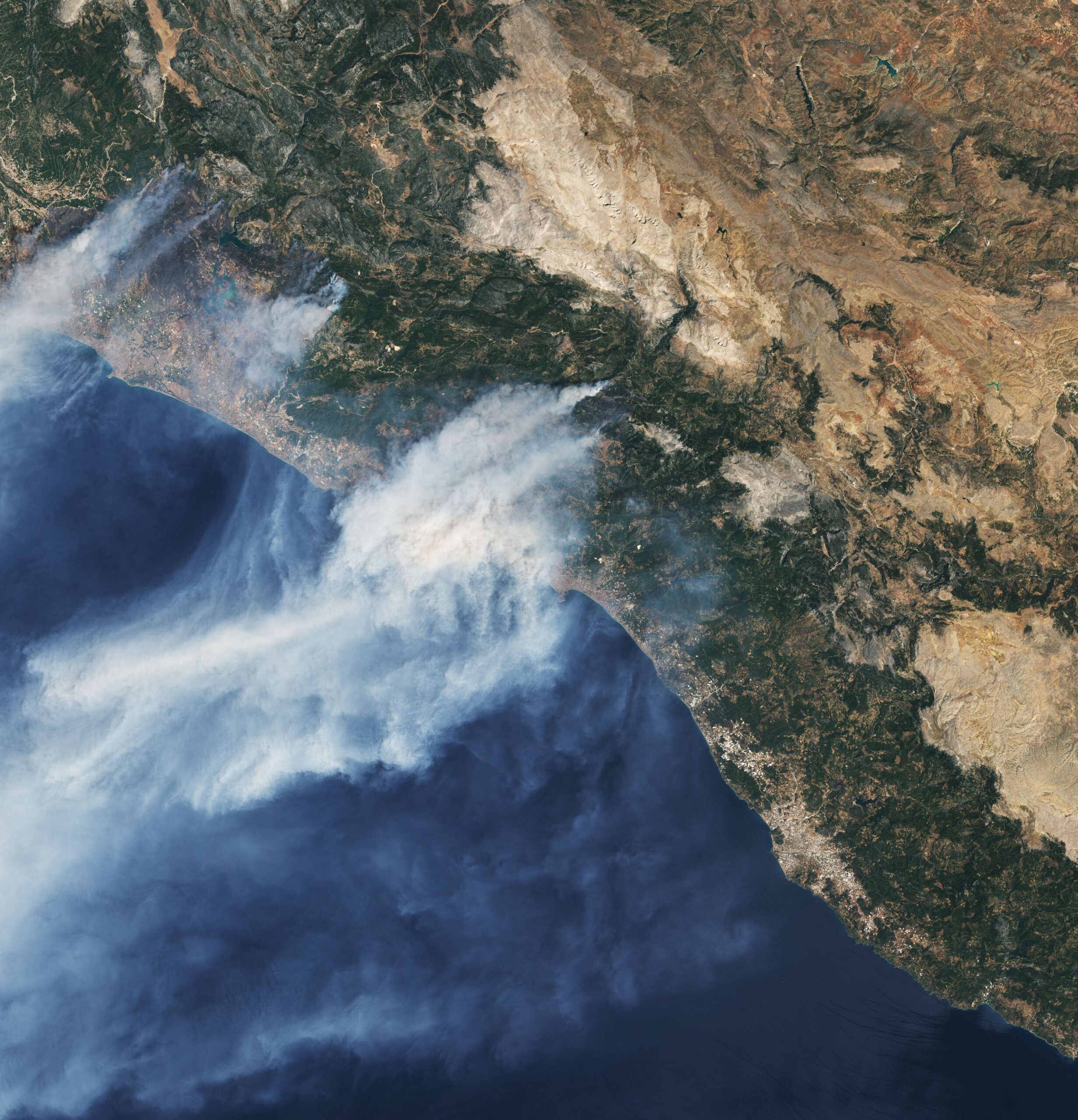
Shocking wildfire outbreak persists in Turkey Today’s Image of the Day from NASA Earth Observatory shows smoke streaming off the southern coast of Turkey, where months of dry weather and record-breaking temperatures have given rise to devastating wildfires.
On July 20, Turkey recorded its hottest ever temperature of 120.38 Fahrenheit degrees in the Cizre district in the southeastern province of Şanlıurfa.
According to NASA, more than 130 wildfires have been reported across 30 Turkish provinces in the last seven days, and most of the fires have ignited along the Mediterranean and Aegean Sea coasts. The National Aeronautics and Space Administration is an independent agency of the U.S. federal government responsible for the civilian space program, as well as aeronautics and space research.
The image was captured on July 31 near the coastal towns of Alanya and Manavgat by the Operational Land Imager (OLI) on Landsat 8. Turkey , officially the Republic of Turkey, is a country straddling Western Asia and Southeast Europe. It shares borders with Greece and Bulgaria to the northwest; the Black Sea to the north; Georgia to the northeast; Armenia, Azerbaijan, and Iran to the east; Iraq to the southeast; Syria and the Mediterranean Sea to the south; and the Aegean Sea to the west. Istanbul, the largest city, is the financial centre, and Ankara is the capital. Turks form the vast majority of the nation’s population, and Kurds are the largest minority.
Image Credit: NASA Earth Observatory
–—
By Chrissy Sexton, Earth.com Staff Writer
News coming your way


