Northern Italy's Po Valley from space
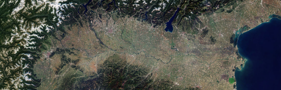

Northern Italy’s Po Valley from space Today’s Image of the Day from the European Space Agency features the most densely populated area in Italy known as Po Valley.
Italy’s longest river, the Po River, flows across the northern part of the country from west to east before reaching a delta that dumps into the Adriatic Sea near Venice.
The river runs through many important Italian cities, including Turin, which is visible to the extreme left of the image.
To the east, the city of Milan can be seen just below the Alps. Milan is the second most populated city and the largest metropolitan area in Italy. Northern Italy’s Po Valley from space
This composite photograph combines several images captured by the Copernicus Sentinel-2 between June 2018 and February 2019.
Due to its central geographic location in Southern Europe and the Mediterranean, Italy has historically been home to myriad peoples and cultures. In addition to the various ancient peoples dispersed throughout what is now modern-day Italy, the most predominant being the Indo-European Italic peoples who gave the peninsula its name, beginning from the classical era, Phoenicians and Carthaginians founded colonies mostly in insular Italy, Greeks established settlements in the so-called Magna Graecia of Southern Italy, while Etruscans and Celts inhabited central and northern Italy respectively.
—
By Chrissy Sexton, Earth.com Staff Writer
Image Credit: European Space Agency


News coming your way