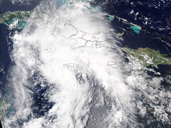
Hurricane Ida continues to strengthen as it approaches Louisiana

Today’s Image of the Day from NASA features Hurricane Ida as it intensified to a tropical storm west of Jamaica and south of Cuba. The true-color image was captured on August 26, 2021 by the Moderate Resolution Imaging Spectroradiometer.
By the afternoon of August 27, Ida had reached hurricane status with maximum sustained winds of 75 miles per hour. By the early hours of August 29, the hurricane had rapidly intensified into a category 4 storm with maximum winds of 150 miles per hour as it approached the Gulf Coast of the United States.
The National Hurricane Center expects Ida to make landfall in southeast Louisiana on Sunday, the 16th anniversary of Hurricane Katrina.
Ida is arriving with extremely dangerous storm surge, destructive winds and torrential rainfall. In parts of Louisiana and Mississippi, water could rise 15 feet above ground level. Ida continues to strengthen, and will likely become the strongest hurricane to ever hit the state of Louisiana.
Image Credit: NASA Moderate Resolution Imaging Spectroradiometer
–—
By Chrissy Sexton, Earth.com Staff Writer
News coming your way


