Fires in the Pampas and Southern Argentina

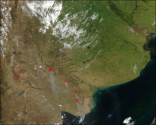
This true-color image from the Moderate Resolution Imaging Spectroradiometer. (MODIS) show fires (red dots) in Argentina on January 18, 2003. Across the Pampas, which is a large, relatively flat grassland (image right), a few small fires were detected. Meanwhile to the south, larger fires were burning and producing grayish smoke plumes. In southern Argentina, the rainy season comes in the winter (Northern Hemisphere summer), and fire season continues from late spring into early summer (Northern Hemisphere fall and winter). Fires in the Pampas and Southern Argentina are very common and happen during the storm season cause major damage. Therefore the red dots indicating the larger fires in the area and even close to coastline.
The Pampas meaning “plain” are fertile South American lowlands that cover more than 750,000 km2. Also include the Argentine provinces of Buenos Aires, La Pampa, Santa Fe, Entre Ríos and Córdoba. Therefore all of Uruguay; and Brazil’s southernmost state, Rio Grande do Sul.
The vast plains are a natural region, interrupted only by the low Ventana and Tandil hills, near Bahía Blanca and Tandil (Argentina), with a height of 1,300 m (4,265 ft) and 500 m (1,640 ft), respectively.
Credit: Image courtesy Jeff Schmaltz, MODIS Rapid Response Team, NASA GSFC
News coming your way


