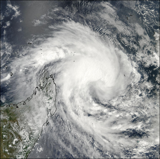
Cyclone 16S Off Madagascar

With sustained Cyclone 16S Off Madagascar winds of 84 km per hour (52 mph), Tropical Cyclone 16S has hovered off Madagascar’s northeastern coast for the last couple of days. This true-color image of the storm was acquired on February 10, 2003, by the Moderate Resolution Imaging Spectroradiometer (MODIS) aboard NASA’s Aqua satellite. The high-resolution image available here is 500 meters per pixel. Visit the MODIS Rapid Response Team, for a copy of this scene at MODIS’ full resolution of 250 meters per pixel.
Madagascar officially the Republic of Madagascar (Malagasy: Repoblikan’i Madagasikara Malagasy pronunciation: French: République de Madagascar), and previously known as the Malagasy Republic, is an island country in the Indian Ocean, approximately 400 kilometres (250 miles) off the coast of East Africa. At 592,800 square kilometres (228,900 sq mi) Madagascar is the world’s 2nd largest island country. Also Cyclone 16S Off Madagascar caused a lot og damage.
The nation comprises the island of Madagascar (the fourth-largest island in the world) and numerous smaller peripheral islands. Following the prehistoric breakup of the supercontinent Gondwana, Madagascar split from the Indian subcontinent around 88 million years ago, allowing native plants and animals to evolve in relative isolation.
Credit: Image courtesy Jeff Schmaltz, MODIS Land Rapid Response Team at NASA GSFC
News coming your way


