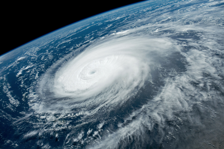
Today’s Image of the Day from NASA Earth Observatory features Super Typhoon Hinnamnor, which rapidly developed into a category 5 storm this week in the Western Pacific Ocean.
While the storm appears to be barreling toward Taiwan in the photo, it ended up taking a turn away from the island, according to NASA.
“On August 30, Hinnamnor became the first category-5 storm on Earth in 2022, as winds reached 260 kilometers (160 miles) per hour,” says NASA. “As noted by Yale Climate Connections, it was pretty late in the year for the first storm of such intensity; an average of 5.3 category-5 storms form each year globally.”
“Forecasters are indicating that Hinnamnor might head for South Korea or southern Japan in the first week of September. Sea surface temperatures are several degrees above average, which could help sustain and strengthen the storm in coming days.”
The image was captured in the late morning of August 31, 2022 by an astronaut on the International Space Station.
Image Credit: NASA Earth Observatory
–—
By Chrissy Sexton, Earth.com Staff Writer


