What is Weather Education – Orographic Thunderstorms?
Orographic thunderstorms
They are formed when the air is pushed up a mountain side. This type of thunderstorm is found only on the windward side of a mountain range. In the United States we would find these types of thunderstorms on the western slopes of the Rocky Mountains and also on the western slopes of the Appalachians.
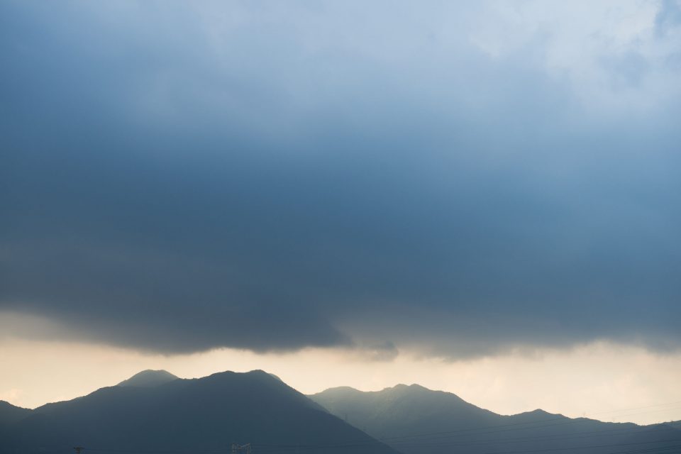
Things that make this thunderstorm important: First of all they only form in certain geographical places on the earth as mentioned above. But they can form anywhere in the world that has mountain ranges. For instance, you can see an orographic thunderstorm developing in the above image.
Secondly these types of thunderstorms create heavy rain on the windward side of the mountain and just on the other side of the mountain no rain will fall. Sometimes you hear what is called a rain shadow and that is referring to the leeward side or the non-windward side of the mountain.
Formation of these types of thunderstorms is as follows:
First, the warm moist air rises from the surface up the slope of the mountain; secondly when the cloud gets too heavy it precipitates itself out on the windward side of the mountain and then it will collapse and dissipate without ever crossing the mountain.
Next, these types of thunderstorms are most common in the late spring and early summer after the earth surface has had enough time to warm. So the next time you are in Salt Lake City or around that area and you see this type of cloud forming near the mountain tops you know what it is and what it means.
Image Caption: An orographic thunderstorm developing on the windward side of a mountain in Japan.
Credit: Joshua Kelly
redOrbit.com Meteorologist Joshua Kelly


